Hiking to Christie falls.
- When – Good all times of year.
- Where – Ladysmith (mid-island).
- Why – Destination hike to waterfall.
- How – multi direction hike ranging from 2 – 4 hours.
- Difficulty – easy / moderate
- Cost – hiking is free.
Location / Directions -(49.0111884N – 123.8780430W)
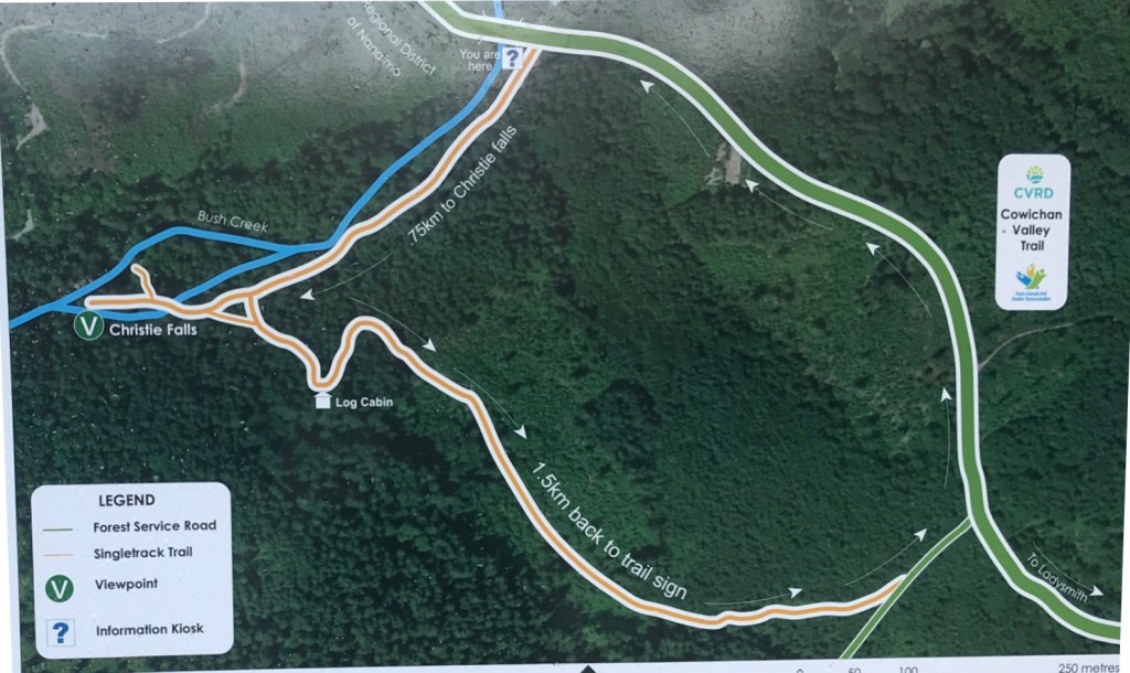
There are numerous rotes you can take to the falls, I will include two of them here.
Route 1 (highlighted in red on the map): From Highway 1 turn southwest on Oyster Slo’l, following the road to the end, approximately 100 meters, parking anywhere along the side.
Route 2 (highlighted in the yellow on the map): From Highway 1 turn onto Grouhel road, then take the first right turn onto Christie road. Follow to the end, then turn left onto Arroyo road and continue a few hundred meters to a gate. Park on the side of the road at the gate.
The Hike –
The path to the falls itself starts at the Ladysmith fish hatchery/sportsman club and is very short at only 0.75km along the river to take in the view. The hike to get to the fish hatchery/sportsman’s club however is a bit longer.
(Route 1 – in red): Google maps marks the start of the trail on Oyster Slo’l road, off Highway 1. This path utilizes logging roads, foot paths, and part of the Trans Canada Trail. A map makes this part of the trail much easier to navigate as there are multiple points where the road splits with no trail markers indicating which direction to take. It’s actually pretty simple, besides some rather large puddles to traverse in the rainy season. At just over 2 km, this is the shorter of the two routes.
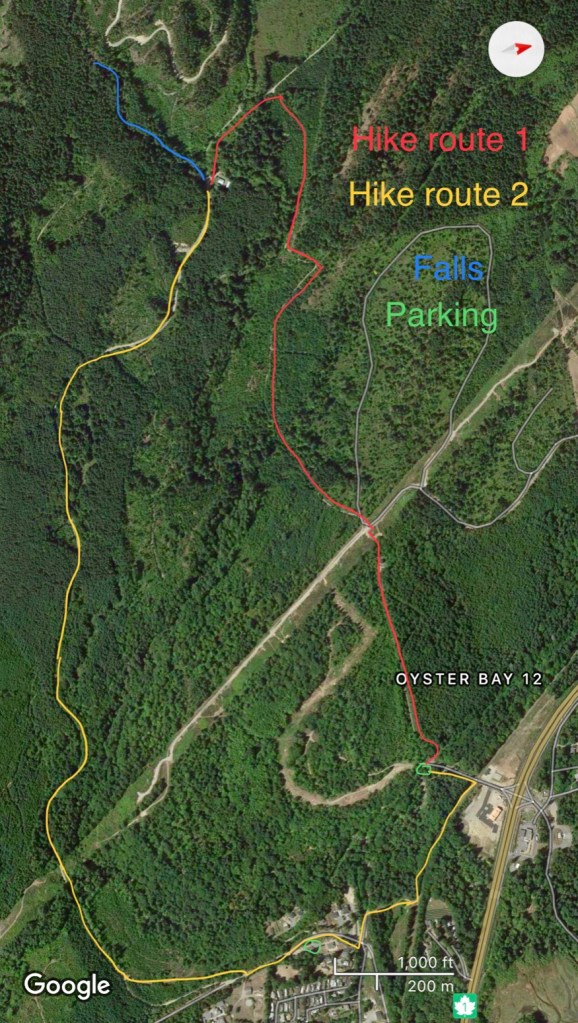
(Route 2 – in yellow) Parking at the end of Arroyo road where the pavement ends at the red gate, this is the start of the road into the Fish Hatchery and Sportsman Club. (If the gate is open do not drive in as it may be locked later on, locking your vehicle in). Start down the gravel road, just a few meters up to the right will be another gate, continue following this road until you reach the end at the hatchery and club. At approximately 3km, this is the longer of the routes in. The two routes meet at the fish hatchery entrance, and continue along the river as one, towards the falls.
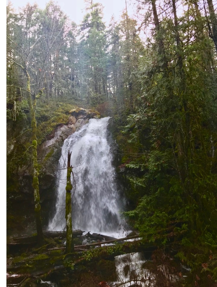
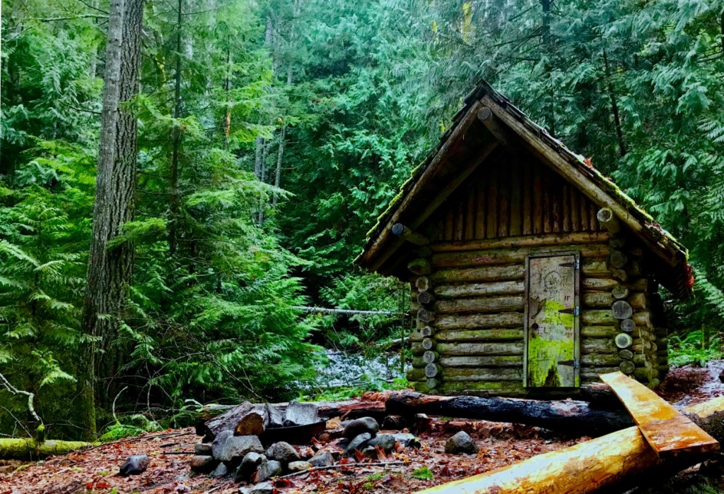
(Trail to the falls – in blue): The first waterfall can be seen from the main trail as it splits off along the river. The trail is 0.75km long and follows along the river side with multiple views of the falls along the way. The trail ends and opens up to the biggest of the waterfalls, where there is lots of space to wander around and find the perfect vantage point to take in the view or snap some photos. Just before you get to the main falls, there is another trail that branches off (additional map above), this passes a small cabin before leading back to the main logging road. This extra loop adds an additional 1.5 km approximately.
The hike can be done in a large loop all at once or as a there-and-back trip, depending on how far you want to go, and is great either way. If following the loop, you will need to walk the train tracks along the highway to connect the 2 routes, crossing a small trestle, which is a nice way to end or start the trip.

