A short hike with a waterfall in Ladysmith B.C.
- Where – Between Ladysmith and Chemainus
- When – All times of year.
- Why – View of waterfall.
- How – Hiking (2.3 km, 1 hour loop).
- Difficulty – Easy.
- Cost – Walking is free.
Directions / Location
From Ladysmith to north entrance :
- From Hwy 1 head northeast on Chemainus Rd For 2.3km.
- Turn right onto gait Rd for 500m.
- Turn right onto finch Pl for 230 to the end of the road.
- Park at the end of the road.
- Map link: https://goo.gl/maps/7Zve6ydSQcabG7jJA
From Chemainus to south entrance:
- From Hwy 1 head northeast on Henry Rd for 1.4
- At the roundabout, take the 3rd exit (to the left) onto Chemainus Rd. 1.7
- At the next roundabout take the 2nd exit (continue straight) and stay on Chemainus Rd for 4.5km
- Turn left on Thicke Rd for 210m
- Park in the parking lot.
- Map link: https://goo.gl/maps/7Zve6ydSQcabG7jJA
- North parking / trail head: 48.960354 – 123.777444
- South parking / trail head: 48.952512 – 123.771236
- Waterfall: 48.956517 – 123.773781
The Hike
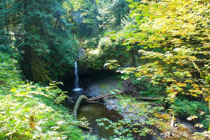
Stocking creek is a 1.3 km long trail system consisting of 2 main trails and connectors that feature a creek and waterfall in the middle that can be seen from a viewing platform. Access to the trails can be found at ether end of the park. Trail maps can be found at each end but the km are only marked on trail pylons.
The kon trail is 1.3 km from parking lot to parking lot, it’s an easy wide, flat, well groomed gravel trail with a ramped bridge at the south end that cross the creek. There are a few steep hills but are manageable for strollers, walkers and wheelchairs.
The huckleberry trail is a scenic 1. km moderate, single track trail, that is accessed from the kon trail on each side and a connector in the middle. The trail is uneven with lots of roots, rocks, mild washouts, mud, some steep sections and a few stairs. The trail runs along the creek side and features a viewing platform to view that waterfall.
Bonus trail!
There is an unmarked but well worn in trail on the opposite side of the creek that leads to the top of the waterfall. It I’d found on the south side the the kon trail just before the bridge.
Notes:
Cell service: yes
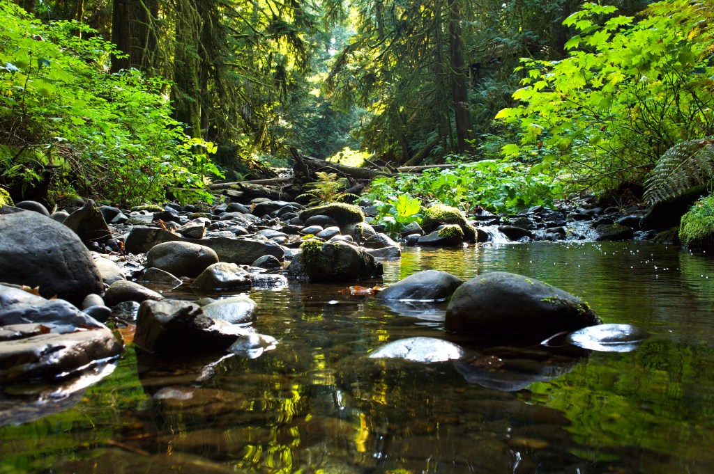
Photo by Mark Dobbs

