A short hike to a rock / ground fissure
- When – All times of year.
- Where – Mid-Island (Nanaimo).
- Why – View point.
- How – Hiking.
- Difficulty – Easy to moderate.
- Cost – Walking is free!
Location / directions 49.1330483 – 123.9691563
From Nanaimo Parkway (Hwy 19) turn onto Fifth street. Follow Fifth for 1.2 km, then turn right onto Howard ave. Follow Howard for 850 m, then turn right onto Seventh street.Continue along Seventh for 2.2 km – Seventh street will turn into Harewood Mines road. Parking and the start of the trail starts under the power lines. Parking can be found on ether side of the road.
The Hike
The trail can be found along the southeast side of the road. A few meters from the roadside, under the power lines, is a trail map showing the Extension Ridge section of the Trans Canada trail. This is the beginning of the trail to the abyss. The first section of trail is well established with plenty of Trans Canada Trail markers (be aware that there are many intersecting paths along the way). The trail becomes slightly more technical as you continue along, including areas with steep inclines, boulders, rocky and rooted sections, as well as uneven footing along the way. There are alternate routes that bypass the more difficult sections, unfortunately many of them are unmarked, so try to stick close to the tree line, keeping the embankment to your right, to ensure that you’re heading in the correct direction.
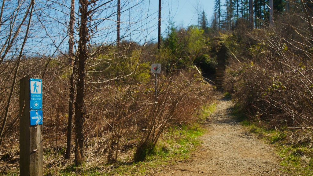
Photo by Mark Dobbs.
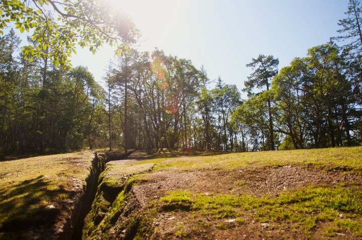
Before you know it, you’ll arrive at your destination – a large fissure in the ground (AKA “The Abyss”), views of the ocean, and glimpses of downtown Nanaimo. At this point you can choose to explore the abyss, continue along the trail to see more of the Extension Ridge, or turn and head back.
(SIDE NOTE: At times gun shots can be heard from the nearby rifle range – not to worry though, the range is in the opposite direction and is clear of any possible gunfire).

