
A long drive and short walk to Myra falls
- When – All times of year.
- Where – Central / North island.
- Why – Waterfall (view point).
- How – Driving and walking.
- Difficulty – Easy.
- Cost – Depends on the fuel efficiency of your vehicle.
Directions / location 49.577058 – 125.565357

Photo by Mark Dobbs
From Nanaimo take Hwy19 North for 140km. (Optional: For a more scenic drive, you can take Hwy19A along the coast. However, keep in mind that it’s already quite a long trip, and this route will eat up even more time.
Turn left at Gold River highway in Campbell River (Hwy 28) and drive for 48km. The Gold River highway will turn right, continue driving straight on Westmin road for another 36km, then turn right at the Myra Falls parking lot entrance (there’s a sign along the edge of the road, but it may be removed during winter months).
From the North end of Nanaimo to the Myra Falls parking lot, the journey is 225km and approximately 2 hours and 45 minutes of driving time. (NOTE: Fuel should be checked and filled in Campbell River as there will be no fuelling point past this point).
The falls
The trail to the falls starts in the parking lot, leading down a steep section to a set of connecting trails. One of the trails branches off to a view point of the upper part of the falls, the other leads to the lower area. The trails are connected so that one may be viewed after the other.
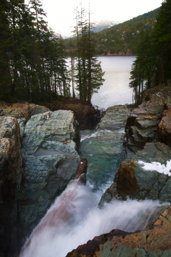
Photo by Mark Dobbs
The lower section opens up to a large pool with an area of exposed rock – it continues to drop off into many smaller falls and finally draining off the edge into Buttle Lake.
The landing area is an open, multi-coloured rock shelf that allows the opportunity to explore from different views and vantage points. If you climb down a few more tiers, more falls can be seen dropping further down. CAUTION: there are no guard rails or any protection along the edges. Is is a good idea to keep small humans and pets back from these edges, and on leash.

