
A short hike with a view
- When – All times of year.
- Where – Central island (Nanaimo).
- Why – Hike to view point.
- How – Hiking.
- Difficulty – modern (ok for strollers).
- Cost – Walking is free.
Location / Direction’s
Located in central Nanaimo, in the Linley Valley/Rutherford area, Rutherford ridge can be accessed from two locations. One entrance lies at the end of Cougar Trail road, and another at the end of Linley Valley drive. Parking is limited at both locations but not difficult to find.
The Hike
Rutherford ridge is a short hike following a rocky ridge to its highest point, where the ridge then flattens out. Along the ridge are the radio towers, and one can take in views from Duke Point, to Mt Benson, as far as Nanoose Bay.
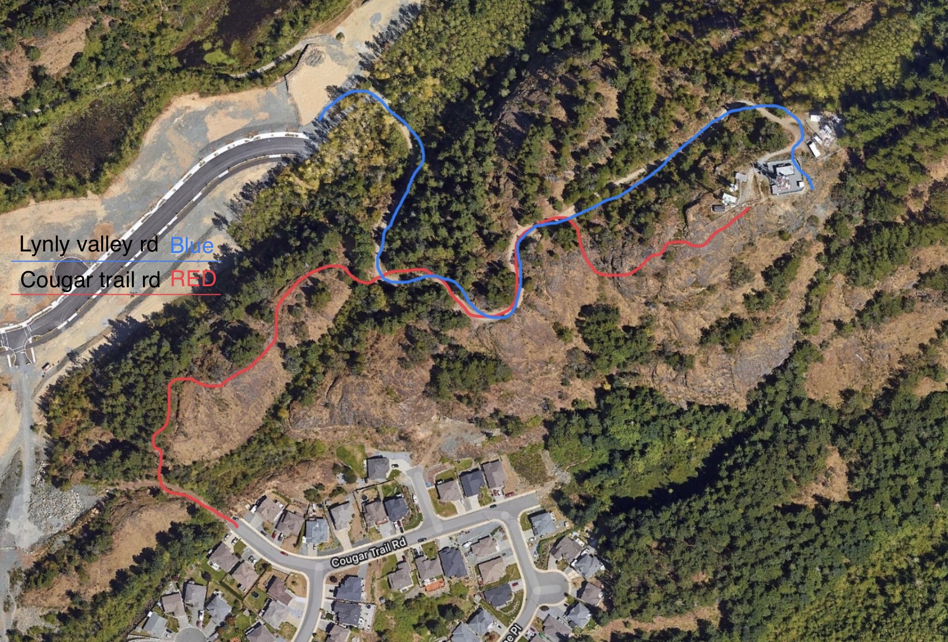
The first trailhead (marked in RED on the map) leads off of a dead-end/unpaved section of Cougar Trail road. About 150 feet from where the street ends, parking where the road is barricaded off, the trail begins on the right. It’s a bit steep, but some well placed footing will start you off without scrambling up the 20ft section. At the top you’ll continue up the dirt trail, as the path then leads onto exposed and moss covered rock. The trail continues along the first ridge, offering a heightened view of the area. The trail will dip down a bit before connecting back to the main gravel road. Following this road, you will pass a yellow gate where you can decide to continue along the gravel road to the top for an easier path, or a smaller trail off to the right hand side, which offers better views as you hike up. The terrain along the smaller trail is steep with loose rock toward the top, so sure footing is required. At the top you’ll find the fenced off radio towers and a view of Nanaimo stretching from Duke Point to Nanoose. Glimpses of the ocean can be seen, but the view is mostly facing inland.
The access point from the Linley Valley side (marked in BLUE) starts at the end of Linley Valley road, where parking can be found and the gravel road starts. The gravel road is gated at the bottom and only has one route to follow on the way up to the top; this is the main road up for workers to service the radio towers. The final view is the same, with the only difference being a slightly less scenic and adventurous path to the top.

